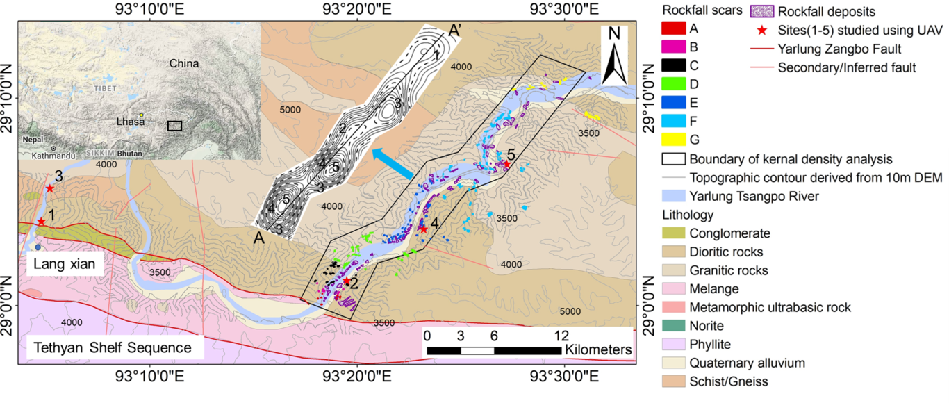
The extent of the fault damage zone remains an outstanding challenge confounding attempts to assess rock mass physical and mechanical properties, the effects on landscape evolution and slope stability, and to delineate safe places for human occupation and infrastructure development. Quantifying the relationship between faulting and the spatial geometrical and mechanical characteristics of a rock mass controlled by faulting is difficult, mainly because of varying lithology and rock mass characteristics, the effects of topography and vegetation and local erosion of weaker rock mass. Recent technological developments including Unmanned Aerial Vehicles, terrestrial laser scanning, photogrammetry and point cloud analysis software tools greatly enhance our ability to investigate the issues using the Yarlung Tsangpo (YLTP) Fault of southern Tibet as a case study where ideal geological conditions exist to investigate the relationship. In this study, the procedures, investigation approaches, evidence and criteria for defining the threshold distance for damage zones of YLTP Fault of southern Tibet were studied quantitatively by combining the spatial variations of fracture density, rock mass strength, rockfall inventory and previous thermal evidence. The results have been compared with published data from the evidence of thermal effects related to the exactly the same fault and show a good match between internal thermal action and rock mass physical and mechanical properties controlled by the same faulting. The extent of threshold distance of damage zone of the YLTP Fault is estimated as 5.9±0.6km. Within the damage zone, fracture density and cohesion of the rock mass show power curve relations with distance from the YLTP Fault. The internal dynamic action of fault controls rock mass physical and mechanical properties in the study area. The fault first affects the characteristics of rock mass structures, and then the orientation of the rock structures influences the stability of slope leading to rockfall.