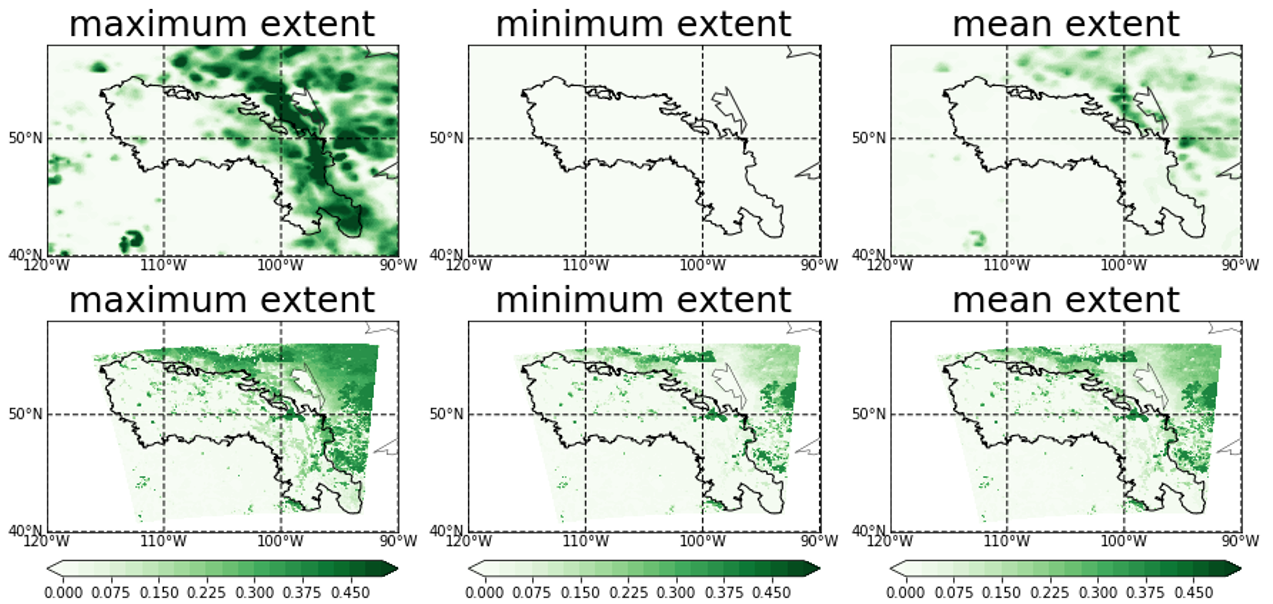
The widely-used Noah-MP land surface model (LSM) currently adopts snow albedo parameterizations that are semi-physical in nature with nontrivial uncertainties. To improve physical representations of snow albedo processes, a state-of-the-art snowpack radiative transfer model, the latest version of Snow, Ice, and Aerosol Radiative (SNICAR) model, is integrated into Noah-MP in this study. The coupled Noah-MP/SNICAR represents snow grain properties (e.g., shape and size), snow aging, and physics-based snow-aerosol-radiation interaction processes. We compare Noah-MP simulations employing the SNICAR scheme and the default semi-physical Biosphere-Atmosphere Transfer Scheme (BATS) against in-situ snow albedo observations at three Rocky Mountain field stations. The agreement between simulated and in-situ observed ground snow albedo in the broadband, visible, and near-infrared spectra is enhanced in Noah-MP/SNICAR simulations relative to Noah-MP/BATS simulations. The SNICAR scheme improves the temporal variability of modeled broadband snow albedo, with a nearly twofold higher correlation with observations (r=0.66) than the default BATS snow albedo scheme (r=0.37). The underestimated variability in Noah-MP/BATS is a result of inadequate physical linkage between snow albedo and environmental/snowpack conditions, which is substantially improved by the SNICAR scheme. Importantly, the Noah-MP/SNICAR model, with constraints of snow grain size from the MODIS snow covered area and grain size (MODSCAG) satellite data, physically represents and quantifies the snow albedo and absorption of shortwave radiation in response to snow grain size, non-spherical snow shapes, and light-absorbing particles (LAPs). The coupling framework of the Noah-MP/SNICAR model provides a means to reduce the bias in simulating snow albedo.