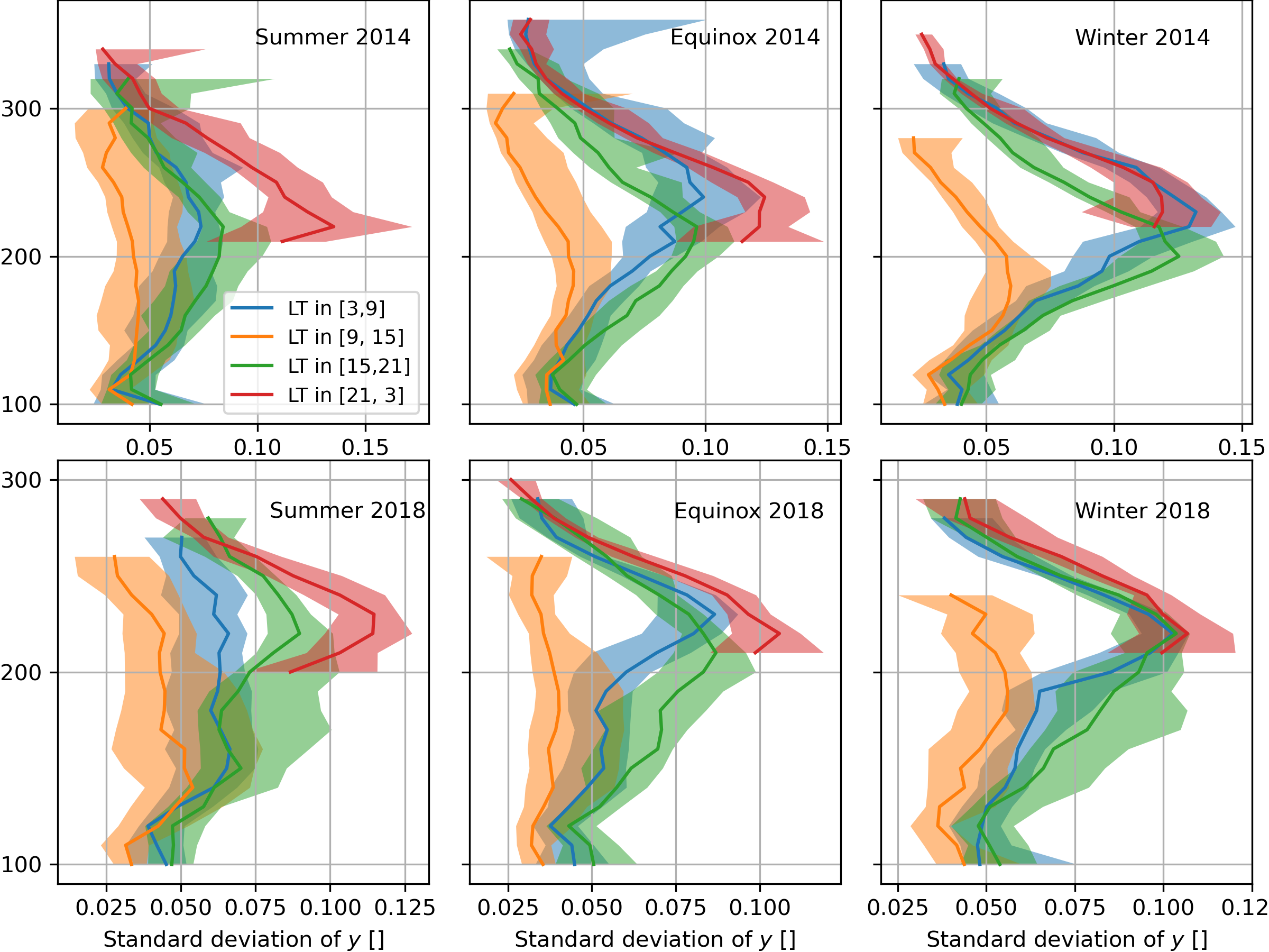
Ground-based Global Navigation Satellite System (GNSS) receivers have become an ubiquitous tool for monitoring the ionosphere. Total Electron Content (TEC) data from globally distributed networks of ground-based GNSS receivers are increasingly being used to characterize the ionosphere and its variability. The deployment of these GNSS receivers is currently limited to landmasses. This means that 7/10 of Earth’s surface, which is covered by the oceans, is left unexplored for persistent ionospheric measurements. In this paper, we describe a new low-power dual-frequency Global Positioning System (GPS) receiver, called Remote Ionospheric Observatory (RIO), which is capable of operating from locations in the air, space, and the oceans as well as on land. Two RIO receivers were deployed and operated from the Tropical Atmosphere Ocean buoys in the Pacific Ocean, and the results are described in this paper. This is the first time that GPS receivers have been operated in open waters for an extended period of time. Data collected between September 1, 2018 and December 31, 2019 are shown. The observed TEC exhibits a clear seasonal dependence characterized by equinoctial maxima in the data at both locations. Both RIO receivers, deployed near the geomagnetic equator, show an 18-35% increase in TEC during moderately disturbed geomagnetic periods. Comparisons with the International Reference Ionosphere model show good agreement. The new capability presented in this paper addresses a critical gap in our ability to monitor the ionosphere from the seventy percent of the Earth’s surface that is covered by water.