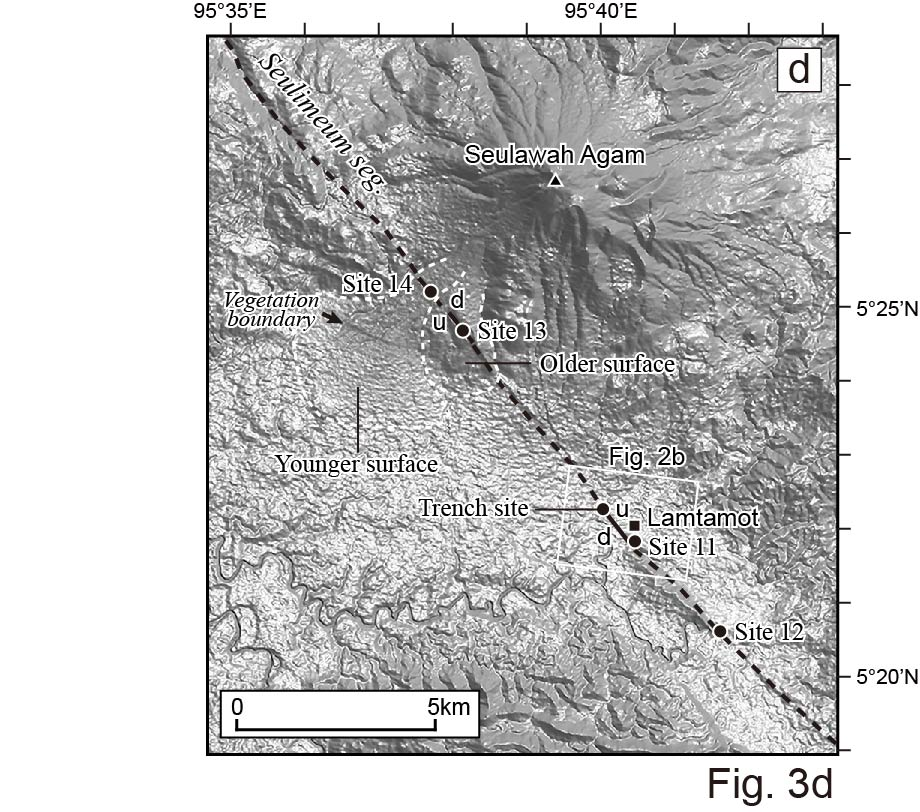
The Sumatran fault is an arc-parallel dextral strike-slip fault that accommodates much of the right-lateral component of oblique subduction of the Indian-Australian plate beneath the Sunda plate. The 1900-km-long fault is divided into multiple segments, some of which ruptured the surface during the moderate to large historical earthquakes. The northern Sumatran fault in Aceh Province has not ruptured in the past 120 years and is considered a seismic gap. Since 2012, we have mapped the northern Sumatran fault based on the ALOS (Advanced Land Observing Satellite) PRISM (Panchromatic Remote-sensing Instrument for Stereo Mapping) satellite images. We also conducted several campaigns of geologic fieldworks. The Sumatran fault in the study area is composed of the Aceh and Seulimeum segments. Both segments exhibit conspicuous tectonic landforms, including fault scarps, aligned saddles, offset streams, and linear valleys. The Aceh segment does not show clear geomorphic evidence of late Quaternary movement north of 5°27’N, and the Seulimeum segment appears to accommodate much of the right-lateral motion. We conducted a trenching survey of the Seulimeum segment at Lamtamot, where the fault offsets fluvial terraces. We identified geologic evidence of four surface-rupturing events that occurred after AD1265-1365 and before AD1892. The average recurrence interval of the surface-rupturing earthquake is calculated at 130-210 years. At least 120 years, close to the shortest estimated average recurrence interval, have passed since the last faulting event. We estimate that the probability of a massive earthquake on the northernmost Sumatran fault is high.