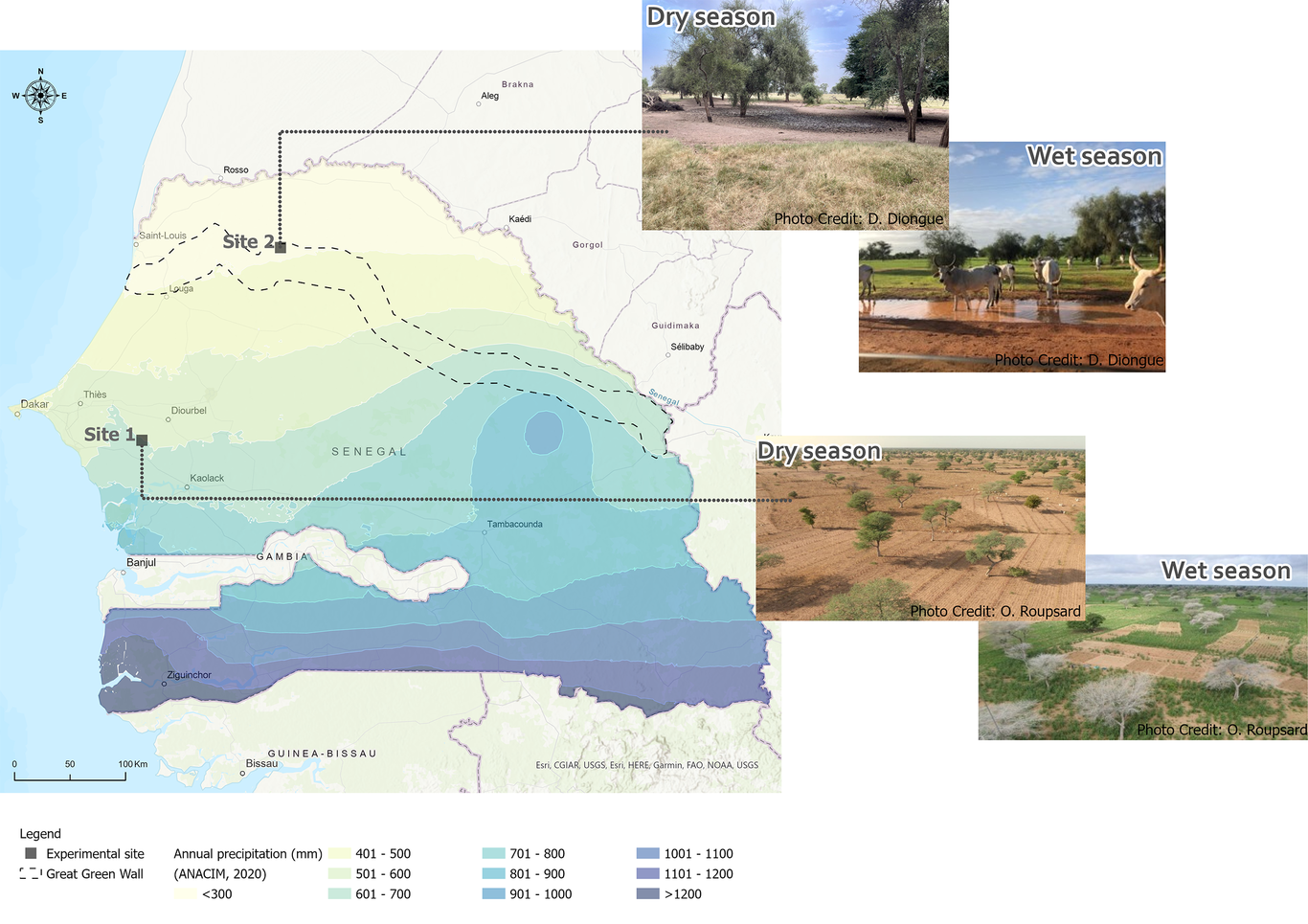
Sustainable water management in semi-arid agriculture practices requires quantitative knowledge of water fluxes within the soil-vegetation-atmosphere system. Therefore, we used stable-isotope approaches to evaluate evaporation (Ea), transpiration (Ta), and groundwater recharge (R) at sites in Senegal's Groundnut basin and Ferlo Valley pasture region during the pre-monsoon, monsoon, and post-monsoon seasons of 2021. The approaches were based upon (i) the isothermal evaporation model (for quantifying Ea); (ii) water and isotope mass balances (to partition Ea and Ta for groundnut and pasture); and (iii) the piston displacement method (for estimating R). Ea losses derived from the isothermal evaporation model corresponded primarily to Stage II evaporation, and ranged from 0.02–0.09 mm d-1 in the Groundnut basin, versus 0.02–0.11 mm d-1 in Ferlo. At the groundnut site, Ea rates ranged from 0.01 to 0.69 mm d-1; Ta was in the range 0.55–2.29 mm d-1; and the Ta/ETa ratio was 74–90%. At the pasture site, the ranges were 0.02–0.39 mm d-1 for Ea; 0.9–1.69 mm d-1 for Ta; and 62–90 % for Ta/ETa. The ETa value derived for the groundnut site via the isotope approach was similar to those from eddy covariance measurements, and also to the results from a previous validated HYDRUS-1D model. However, the HYDRUS-1D model gave a lower Ta/ETa ratio (23.2%). The computed groundwater recharge for the groundnut site amounted to less than 2% of the local annual precipitation. Recommendations are made regarding protocols for preventing changes to isotopic compositions of water in samples that are collected in remote arid regions, but must be analysed days later. The article ends with suggestions for studies to follow up on evidence that local aquifers are being recharged via preferential pathways