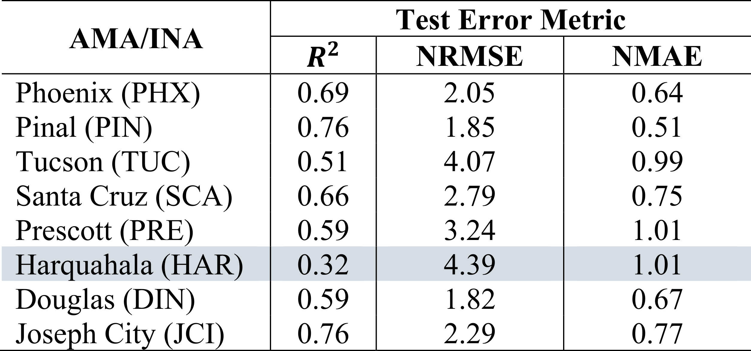
Groundwater is the largest source of Earth’s liquid freshwater and plays a critical role in global food security. With the rising global demand for drinking water and increased agricultural production, overuse of groundwater resources is a major concern. Because groundwater withdrawals are not monitored in most regions with the highest use, methods are needed to monitor withdrawals at a scale suitable for implementing sustainable management practices. In this study, we combine publicly available datasets into a machine learning framework for estimating groundwater withdrawals over the state of Arizona. This extends a previous study in which we estimated groundwater withdrawals in Kansas, where the climatic conditions and aquifer characteristics are significantly different. Datasets used in our model include energy-balance (SSEBop) and crop coefficient evapotranspiration estimates, precipitation(PRISM), and land-use (USDA-NASS Cropland Data Layer), and a watershed stress metric. Random forests, a widely popular machine learning algorithm, are employed for predicting groundwater withdrawals from 2002-2018 at 5 km spatial resolution. We used in-situ groundwater withdrawals available over the Arizona Active Management Area (AMA) and Irrigation Non-Expansion Area (INA) from 2002-2010 for training and 2011-2018 for validating the model respectively. The results show high training (R2 ≈ 0.98) and good testing (R2 ≈ 0.82) scores with low normalized mean absolute error ≈ 0.28 and root mean square error ≈ 1.28 for the AMA/INA region. Using this method, we are able to spatially extend estimates of groundwater withdrawals to the whole state of Arizona. We also observed that land subsidence in Arizona is predominantly occurring in areas having high yearly groundwater withdrawals of at least 100 mm per unit area. Our model shows promising results in sub-humid and semi-arid (Kansas) and arid regions (Arizona), which proves the robustness and extensibility of our integrated approach combining remote sensing and machine learning into a holistic, automated, and fully-reproducible workflow. The success of this method indicates that it could be extended to areas with more limited groundwater withdrawal data under different climatic conditions and aquifer properties.