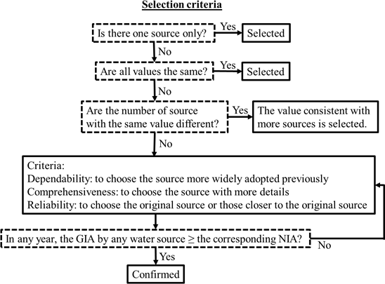
Irrigated cultivation, as a prevalent anthropogenic activity, exerts a significant influence on land use and land cover, resulting in notable modifications to land-atmosphere interaction and the hydrological cycle. Given the extensive cropland, high productivity, compact rotation, semi-arid climate, intense irrigation, and groundwater depletion in the North China Plain (NCP), the development of a comprehensive crop-irrigation-groundwater model becomes imperative for understanding agricultural-induced climate response in this region. This study presents an integrated crop model explicitly tailored to the NCP, which incorporates double-cropping rotation, irrigation practice, and groundwater interactions into the regional climate model. The modifications are implemented to: (1) enable a seamless transition from field scale application to regional scale application, facilitating the incorporation of spatial variability, (2) capture the distinctive attributes of the NCP region, ensuring the model accurately reflects its unique characteristics, and (3) reinforce the direct interaction among crop-related variables, thereby enhancing the model’s capacity to simulate their dynamic behaviors. The integrated crop modeling system demonstrates a commendable performance in crop simulations using climatic conditions, which is substantiated by its identification of crop stages, estimation of field biomass, prediction of crop yield, and finally the projection of monthly leaf area index. In our next phase, this integrated crop modeling system will be employed in long-term simulations to enhance our understanding of the intricate relationship between agricultural development and climate change.